Mineral exploration is the process of searching for evidence of any mineralization hosted in the surrounding rocks. The general principle works by extracting pieces of geological information from several places and extrapolating this over a larger area to develop a geological picture. Exploration works in stages of increasing sophistication, with cheap, cruder methods implemented at the start, and if the resultant information is economically interesting, this warrants the next, more advanced (and expensive) techniques. However, it is very rare to find sufficiently enriched ore bodies, so most exploration campaigns stop after the first/couple of stages.

Exploration stages show how after the initial desk study research, each subsequent stage becomes less and less likely. To put into numeric context: Despite thousands of prospecting licenses, only a few qualify for to be modern mines.
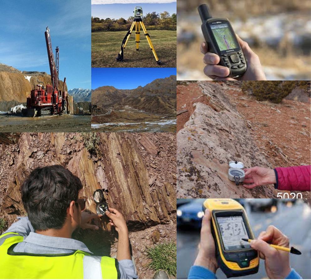
Mapping is the foundation of all geological-related studies, whether it be geotechnical, groundwater, geohazards or mineral exploration, etc. It is vital for developing the base-level picture of an area’s geology, with each subsequent step of work in an area building off and correlating back to this initial stage. When mapping with a mineral exploration focus, quite often prospecting will be conducted alongside. Modern mapping involves the use of GPS, Differential GPS, and Tacheometric / Topographical surveys.
Soil is composed of several layers, and one in particular ‘catches’ the metal ions leaking from the underlying rocks, accumulating a mineral-rich horizon. This is the desired layer in soil sampling, from which a 1kg specimen is collected to test the chemistry of the geology beneath. This technique is extremely important for collecting data in the countryside where the rocks are blanketed by soil and vegetation.
The water is the best media carrying information about the subsurface minerals through which it drains/seeps. This is also applicable to the areas where no outcrops are found.
This method works on the principle that sediment material in stream beds is derived from the erosion of the rocks further upstream. Therefore sampling this material in various locations can give clues as to the geology of the upland area, as well as being tested for their chemistry to provide hints as to whether any metals of interest may be hosted within.
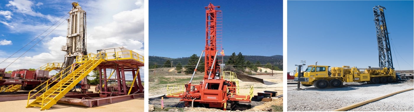
Drilling is the peak of a mineral exploration campaign. It is an extremely expensive process and so will only be used in the rare locations which have proven considerably interesting for their mineral potential. However, in these few places, drilling provides physical evidence of the rock below, and is used to confirm the theories of the underlying geology which were developed during earlier techniques such as soil sampling etc. Drilling is an essential component of late-stage exploration projects.
Whereas the above methods analyze the chemistry (directly or indirectly) of the geology below the surface, geophysics is used to test for the physical properties of the rock. These techniques can offer another side of the story to any geological theories, and so an exploration campaign can quite often compare and collaborate with both geochemical and geophysical studies. The main geophysical methods are the processes of magnetic, electromagnetic, electrical resistivity, induced polarisation, seismic, and radiometric surveys.